cool things no 1 gvsig mobile
I’ve been looking at a couple of “cool things” recently that don’t seem to have picked up much coverage in the blogosphere, so I’m going to do a series of occasional posts on them. The first is GvSIG Mobile and the Tellus Project.
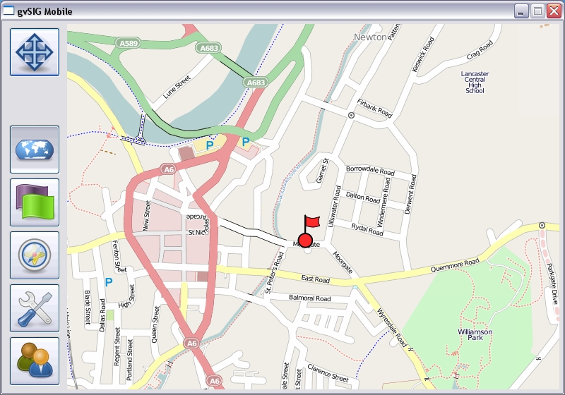
GvSIG Mobile is a development from Prodevelop in Spain, to create an optimised version of GvSIG for small-screened mobile devices such as smartphones and netbooks. The Tellus project links GvSIG mobile with an embedded mobile database, and allows you to synchronise with a remote database, eg PostgreSQL either on demand or when you choose (eg when you have a data signal), using OpenMobileIS.
What you get is a GIS package, allowing you to add base mapping either from your local device or via WMS, and the ability to edit a vector layer on top using on-board GIS or by drawing on the screen. You can add attribute data, and store it locally, then synchronise with a remote database, with full conflict resolution. All in open source- just install it on your device of choice!
[caption id="" align=“aligncenter” width=“400” caption=“GvSIG Mobile screenshot”] [/caption]
We think this is fantastic. In it’s current very simple form, we can see many uses for this as, say, a simple remote issue-recording device. We’re adapting this for use as a full relational on-site recording tool for archaeologists, but it could easily work for environmental staff or anyone trying to record data outdoors, perhaps in areas where there isn’t always a good 3G signal.
This is an ongoing project, but is fully working, so if you’d like more information, then get in touch!